Saturday, August 31, 2019

Dorian Projected to Spare Tampa Bay area

With the projected turn, parts of Tampa Bay left the cone with this morning's 8am ET update.  This is the 11am update where the entire Bay area is outside of the cone.  

We stay on guard and hope for more turning to protect the east coast of the US and the Bahamas!


Friday, August 30, 2019

Dorian!

We just returned from a summer-long RV trip across the country to be welcomed by the Florida State of Emergency ahead of Hurricane Dorian.

As we've monitored its progress over the past few days we've become concerned, however, I always feel better when we are in the center of the cone five or more days out.  As the storms tend to move (not always) as they get closer and observing over the past 15 years, it seems like when we are NOT in the cone of uncertainty farther out, we end up in it closer to landfall. 

Case in point:


While we are still in the cone, it's looks like the predicted storm path could turn north once over the peninsula.  Not good for our state in general, but being in the Tampa Bay area, we feel for the other side of the state but also stay focused on our locale.

Saturday, June 01, 2019

2019 Hurricane Season Officially Begins....

The 2019 U.S. hurricane season officially begins today.  The good news: It's predicted to be a near-normal Atlantic season, according to the National Oceanic and Atmospheric Administration, which means only two to four major hurricanes will be on the way. The bad news: Despite the small number, any hurricane threatens to be among the most powerful storms in U.S. history. 

Sunday, August 19, 2018

A Year Later....

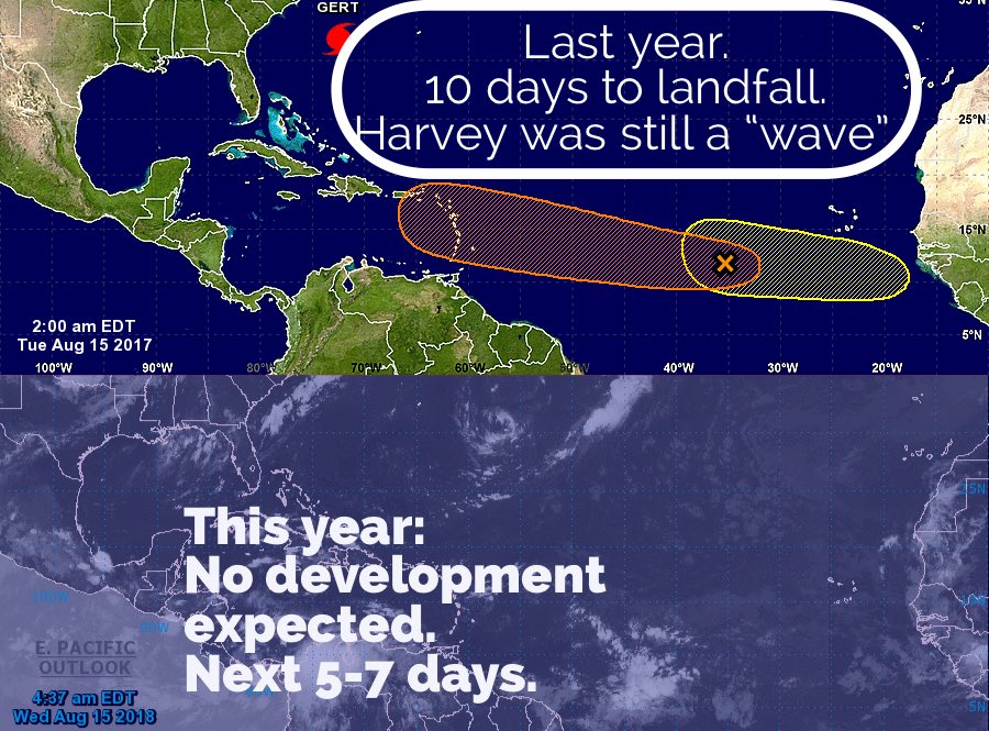
The news media here in Florida (as well as around the Southeast) has been reminding us that the disastrous 2017 hurricane season began its run as Hurricane Harvey was forming a year ago.

We're fortunate that this year it would seem that things are much more calm:


Of course, this past week marked the 14th anniversary of Hurricane Charley hitting Florida (August 14th, 2004) that started it all for this blog.  Actually, it was email updates to family & friends throughout the 2004 hurricane season that morphed into this blog with our first post on June 9, 2005 as Arlene became the first named storm of the season.  She formed just days into a season that would see 28 named storms (including Katrina & Wilma) and worry us in Florida as much as the 2004 season.

Sunday, July 15, 2018

9 Months Later....

After Irma, we left town on a 40 day RV trip to New England and watched the aftermath of Irma and the next month and a half of the 2017 hurricane season.  The devastation in the Caribbean was heartbreaking.

Beyond the physical and emotional suffering of the residents of Puerto Rico and the Virgin Islands, we were especially saddened by the destruction of St. Croix where we had been in December of 2016 for our son's wedding at the (once) beautiful Caneel Bay Resort.


The pictures that came back from that part of the world are much better documented by the professionals.  All we can say is that after 10+ years of mostly non-events here in the Tampa Bay area (as documented on this blog over that time period), it was our turn in the barrel.  Fortunately some minor tree damage, a yard full of twigs and 2 days without power, were nothing to complain about.

And I won't.

What I will complain about is how slow it was and still is to help our fellow citizens in Puerto Rico.

We had planned to start our trip the day Irma hit, but had to delay our departure from Florida to Friday, September 15th.  We had heard that the traffic RETURNING to Florida on I-75 was heavy and that diesel fuel was short.  Along the way we certainly saw more traffic southbound than in our direction.  Diesel WAS spotty but available and the biggest impact seemed to be shredded roadside billboard and streams of power and tree cutting trucks headed to Florida.


Now, a month into the 2018 season, with prediction from below-normal to normal activity, we stay prepared and ready, should we be affected as little or more than Irma did last year.

Saturday, September 16, 2017

Irma Post Mortem

For the first time since I started this blog 12 years ago, I've been too busy dealing with the hurricane to blog about it.

That said, here in the Tampa Bay Area, we were fortunate, make that, VERY fortunate to, for the most part, just suffer minor damage, mostly trees, fences and pool screens.  The biggest issue most of us faced was power outages, which some are still waiting to be restored.

As for us, power was back on at Noon Tuesday.  We spent the better part of 3 1/2 days of oak tree branches, leaves and debris clean up.


We spent Sunday night watching Irma coverage on TV until a transformer finally blew and the power went out.  My wife, son and daughter-in-law spent the night trying to sleep in an interior room of about 50 square feet.  It wasn't so bad because the wind wasn't as bad as expected and the interior temperature wasn't bad.  

We awoke to the before mentioned tree damage.  Interesting to watch our neighbors slowly emerge to also assess the situation, on their property.  Besides the power outage, we also lost our AT&T connectivity.  We were without the entire day.   Our daughter-in-law's work phone is Verizon so she was able to post our status on Facebook and we had a phone to call a few family members to let them know we were okay.  

Despite living in Florida for most of the past 30 years and blogging on this topic for over 1/3 of that time, this was the first hurricane that we really went through.  

Once is enough!

Finally, a few of my favorite Irma Internet memes:


Saturday, September 09, 2017

Waiting on Irma's Turn

The forecasted track has continued to shift west over the past several days as the weather ridge that has been steering the storm and keeping it from turning North, has not weakened as originally expected.

This morning we find the path coming up the west coast of Florida and towards the Tampa Bay area.

Sunday Night into Monday is when the damaging winds are predicted for our area.

We can only hope that the ridge remains strong and the turn is even farther west.  That would keep the strongest winds offshore, but we'll be on the strongest side of Irma.

In any case, it's not good.  We'll be monitoring the system for the next 48 hours as meterologists expect the exact path to shift slightly which will determine who in the Bay Area gets the worst of "Irmageddon"

Wednesday, September 06, 2017

Chasing Away Irma

Our grand-dogger is doing her part.....


The Hunt For Water....

Tuesday (9/5/17) was fruitless.

By 11am, there was none to be found.

Anywhere!

Grocery store managers began rationing awaiting replenishment which is on its way from their warehouses.

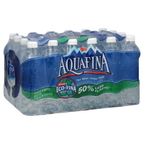
This morning, Wednesday, (9/6/17), my corner Winn-Dixie was still without.  Publix across the street was limiting shoppers to one 24-pack of Aquafina, at full (but not over) price, $4.99.   A very active scene at 7am.

I expect there to be enough water available as we head into the weekend and hoarders are satisfied and the rest of us can get the suggested 1 gallon per day per person for at least 3 days.

Meanwhile the cone still includes the west coast of Florida but the models are slowly shifting east. Fingers crossed it pushes far enough east to miss us and all along the east coast of Florida and the Carolinas!

Tuesday, September 05, 2017

Irma wakes up Florida

After watching the terrible devastation in and around Houston over the past couple of weeks, all Floridians necks' twisted sharply 180 degrees to see what is now Hurricane Irma begin it's trek across the Atlantic.  While Houston overshadowed the pending approach to the US East Coast, we've been watching and hoping for the familiar "turn to the north" and spin "out into the North Atlantic".

No such luck.

Over the weekend the Tampa media really began it's balanced approach of "be prepared" but do not panic".   There are too many variables this far out.


When the governor declared a preemptive "State of Emergency" yesterday (Labor Day), it was the signal to begin to deplete the shelves of hurricane supplies, especially bottled water.  I plan to head out today to get ours.   Most of the other items on the emergency supply list are in house here already, primarily just through normal purchases over the past couple of years.

The State of Emergency is also designed to help prevent price gouging.  Always an issue after the storm but sometime before.

There is a general sense of "uneasiness" in the state as the unknown of where the storm will potentially make landfall remains a constant.  Plus with the variables, no one knows for sure how they may be impacted other than to know that next Sunday and Monday are likely to be the "weather days".   As a Category 5 storm, there will be impact, but who and where remains to be seen!

Stay tuned...